GPR & Geophysical Survey Services
From field data collection to fully processed deliverables, Geomorph Imaging Solutions provides complete ground penetrating radar (GPR), magnetometer, and thermographic survey services across archaeology, infrastructure, construction, and defence applications.
Our teams operate professional-grade, multi-frequency equipment in the field and deliver interpreted, decision-ready results — not just raw data.
Ground Penetrating Radar Surveys
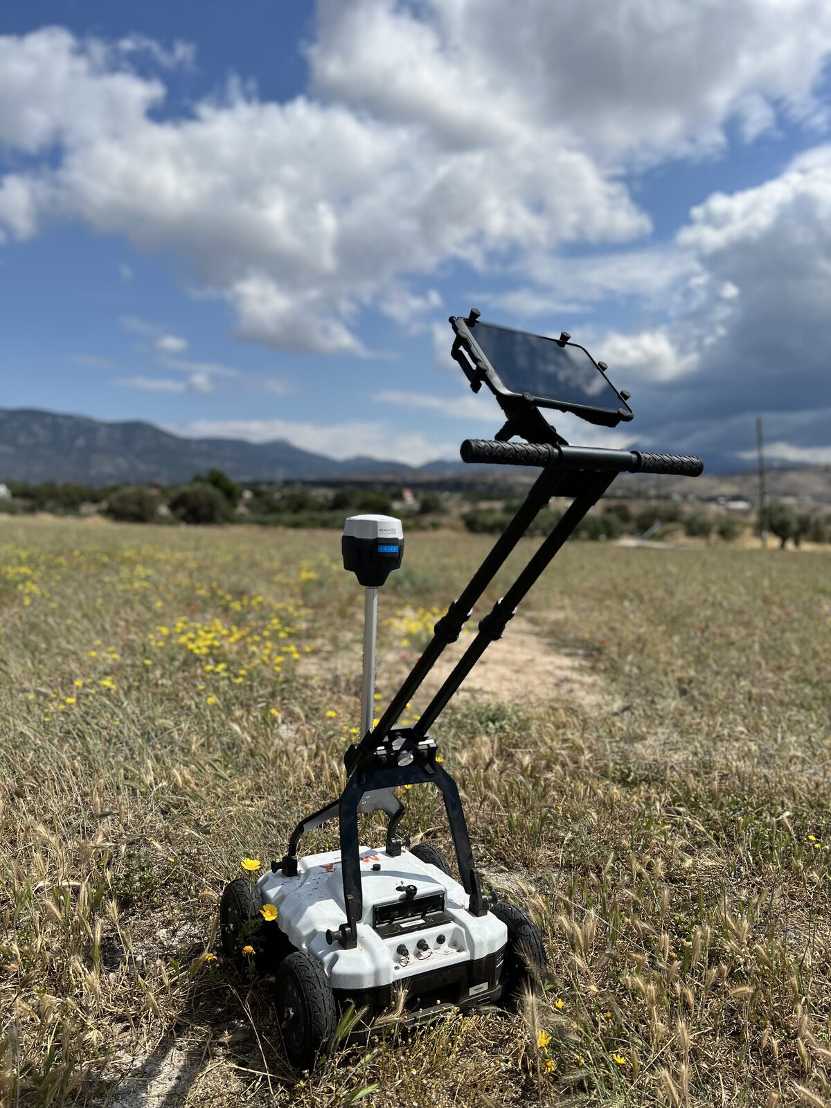
Ground penetrating radar is our core survey method, used to non-invasively map what lies beneath the surface across a wide range of project types. We deploy multi-frequency GPR systems calibrated to the target depth and resolution required for each application.
Archaeological GPR Survey
Non-destructive subsurface mapping to identify buried structures, voids, and archaeological features before excavation begins — protecting cultural heritage assets while supporting development and research timelines.
Utility Detection & Mapping
Locating buried pipes, cables, and unknown utilities ahead of excavation, drilling, or construction — reducing the risk of utility strikes and costly project delays.
Void & Cavity Detection
Identifying subsurface voids, sinkholes, cavities, and ground instability risks beneath buildings, roads, and development plots.
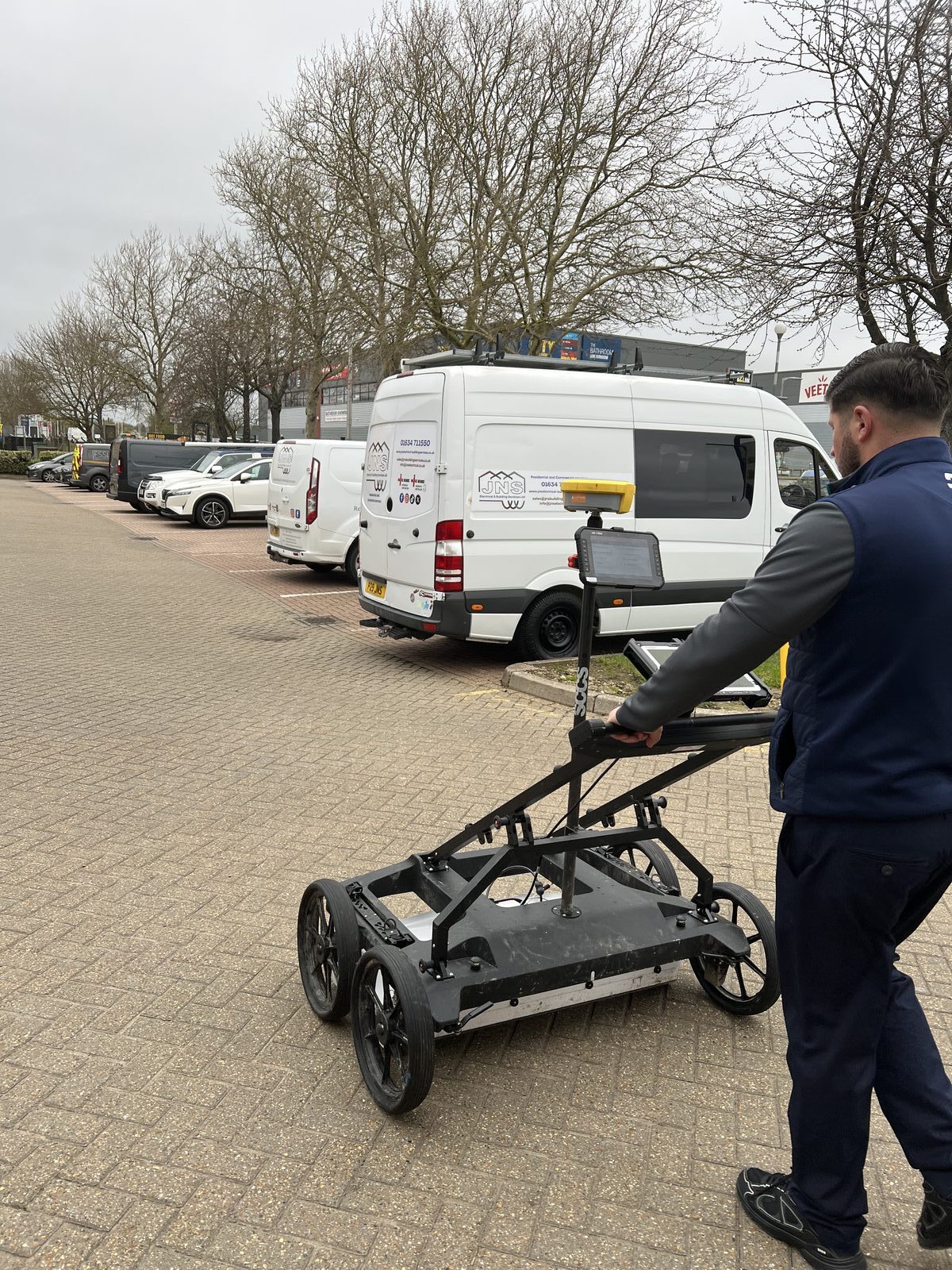
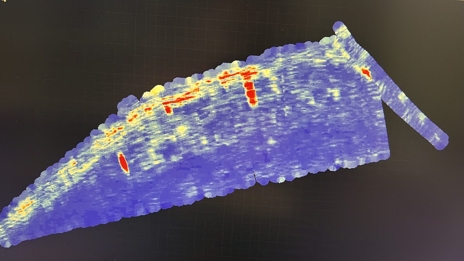
GPS-tracked GPR cart deployed for a utility and subsurface mapping survey on a commercial site.
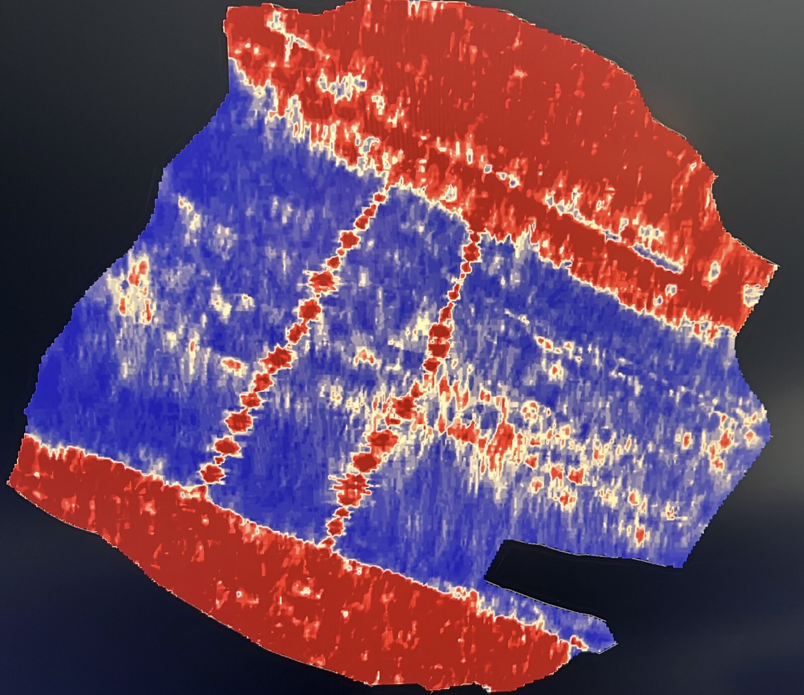
Processed amplitude time-slice revealing clear linear and circular subsurface anomalies for interpretation.
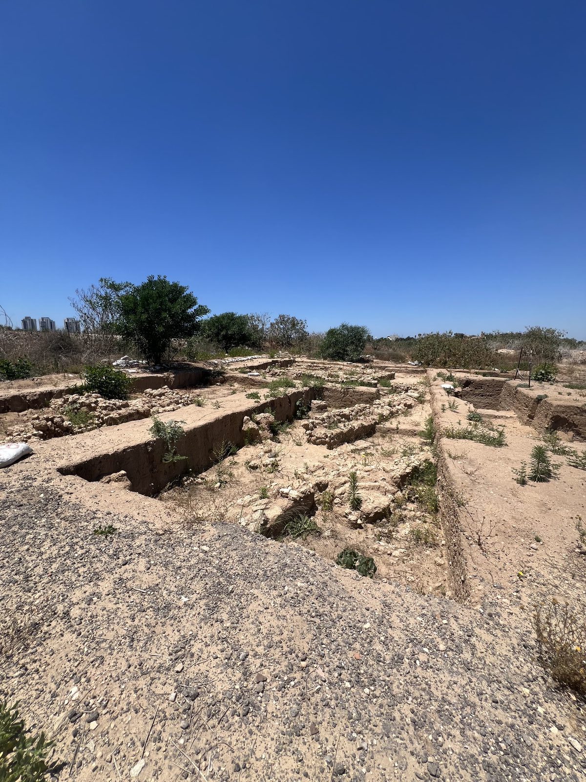
Excavation confirming the buried features identified during GPR processing and interpretation.
GPR for Concrete Scanning
GPR concrete scanning provides a safe, non-destructive way to see inside concrete structures before cutting, coring, or drilling — protecting both workers and structural integrity.
Rebar & Reinforcement Mapping
Precise location of rebar, reinforcement mesh, and rebar spacing within slabs and structural elements.
Post-Tension Cable & Conduit Detection
Locating post-tension cables, electrical conduits, and embedded utilities to prevent dangerous and costly strikes during cutting or coring works.
Voids & Delamination Detection
Identifying internal voids, honeycombing, and delamination that can compromise structural performance.
Concrete Deterioration Assessment
Assessing subsurface deterioration, moisture ingress, and degradation patterns that aren’t visible from the surface.
Infrared Thermography for Structural Diagnostics
Infrared (IR) thermography complements GPR concrete scanning by detecting thermal anomalies linked to moisture ingress, delamination, and subsurface defects — often confirming and cross-validating GPR findings in a single combined assessment.
Building Envelope Inspection
Detecting heat loss, insulation gaps, and moisture intrusion across roofs, façades, and building envelopes.
Bridge Deck Deterioration Mapping
Identifying delamination and subsurface deterioration patterns across concrete bridge decks and structural slabs.
Pre-Renovation Diagnostic Survey
Thermal assessment ahead of renovation works, flagging hidden moisture and structural issues before they become costly surprises.
Used together, GPR and thermography provide a more complete diagnostic picture than either method alone: GPR resolves the physical geometry and depth of a feature, while thermography reveals active thermal and moisture behaviour at the surface. We frequently deploy both methods on the same site visit, giving clients a single, cross-validated report rather than two separate, harder-to-reconcile datasets.
Magnetometer Surveys
Magnetometer surveys detect and map ferrous and magnetically susceptible buried objects and subsurface anomalies, complementing GPR in scenarios involving metallic targets, archaeological features, or unexploded ordnance (UXO) screening.
Archaeological & Heritage Sites
Mapping kilns, hearths, ferrous artefacts, and magnetically distinct archaeological features alongside GPR data.
UXO & Ordnance Screening
Detecting unexploded ordnance and buried metallic hazards ahead of construction or land development in at-risk areas.
Combined GPR–Magnetometer Surveys
Running magnetometer and GPR data on the same project to cross-validate findings and build a more complete subsurface picture.
Field deployment, backed by PhD-level interpretation
Unlike instrument resellers or single-method survey crews, our team combines hands-on field deployment with applied geophysics expertise and proprietary post-processing software. Every survey we run is backed by the same rigour we apply to our independent consulting work — so you get both the data and a confident, defensible interpretation of what it means.
- Vendor-neutral equipment useWe are not tied to any single manufacturer — method and instrument selection is driven by your project, not a sales relationship.
- Multi-method capabilityGPR, magnetometer, and thermography can be combined on a single site visit for cross-validated results.
- Interpreted, not just raw dataEvery survey deliverable includes expert interpretation — the same standard we apply to our consulting practice.
- Cross-sector field experienceFrom archaeological sites to defence applications, our crews have deployed across infrastructure, heritage, construction, and security contexts.
Need a survey crew, expert interpretation, or both?
Tell us about your site and objectives, and we’ll recommend the right method — or combination of methods — for the result you need.
Already have survey data and need independent interpretation rather than fieldwork? See our GPR & Geophysical Consulting services.